INTRODUCTION
This document was created to give guidelines for development in the city of Anaheim. Katella Avenue is a major thoroughfare in the city, connecting multiple key destinations, including the Disneyland Resort, Anaheim Convention Center, Angels Stadium, ARTIC, and the Honda Center. The design guidelines will aim to create a comprehensive identity for the portion of Katella Avenue that connects these key destinations.
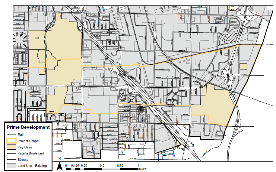
Figure 1.1 – 1: The approximate focus of the corridor plan is between the Disneyland Resort to the west, and the eastern city limits along the Santa Ana River.
The extent of the project is along Katella Avenue, generally between Walnut Street and the eastern city limits (Figure 1.1 – 1). This stretch of the boulevard is an important corridor in the city, as well as in the county. Major destinations and economic drivers are all linked together by this approximately 2-mile length of Katella.
DEVELOPMENT OPPORTUNITIES

Figure 2.1 – 1: Opportunities for new development can be found along the entire length of Katella; a concentration of such parcels can be found at industrial areas in the Platinum Triangle area.
As the Prime Development Map (Figure 2.1) shows, there is ample opportunity for new developments all along the boulevard. Granted, there are certain locations where development opportunities under these criteria are more concentrated. Generally, there is more opportunity in the Platinum Triangle, east of Interstate 5. As formerly industrial sites are left unoccupied, this area is opening to new developments. With Angels Stadium not far away, this could be a hub of new development soon (Khouri, 2015).
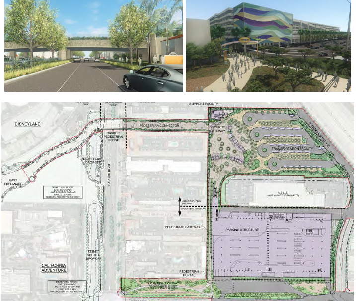
Figure 2.3 – 2: The new Disneyland Resort parking structure will be built at the intersection of Disney Way and Clementine Street, with direct access from the northbound 5 Freeway. Guests will access the theme parks via a pedestrian bridge spanning Harbor Boulevard. (Pimentel, 2016).
Under construction across Harbor Boulevard from Disneyland is a new transit center and parking garage for Disney guests. The parking garage will primarily serve as the parking destination for visitors travelling northbound on Interstate 5, with a dedicated off-ramp for said visitors (Pimentel, 2016).
The seven-story, 6,800 space, parking structure is intended to take stress off increasingly crowded Disneyland parking lots, and Anaheim city streets. With parking, bus stops, and a pedestrian bridge connection directly into the Disneyland Resort, the new facility will potentially aid in traffic and pedestrian flows in the entire Anaheim Resort district (Pimentel, 2016).
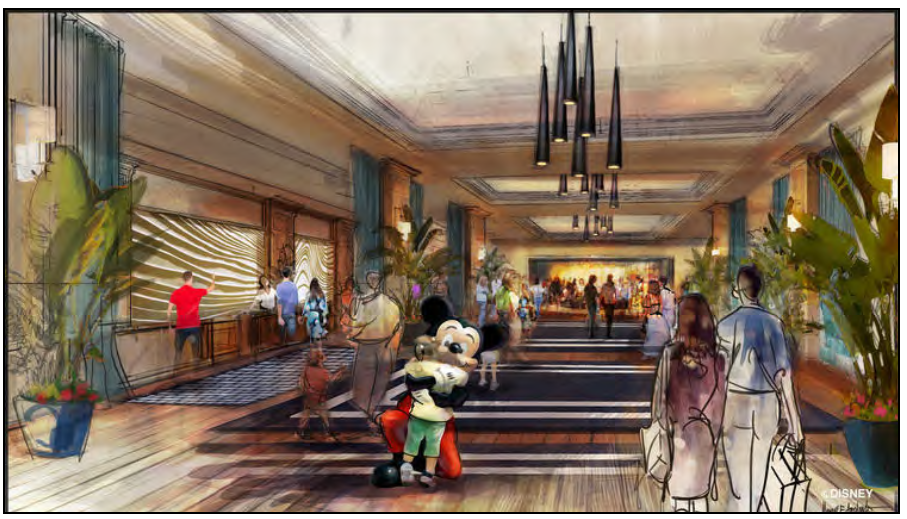
Figure 2.3 – 3: The new hotel would have a distinctly high-end appeal and rating, qualifying it for property tax reduction incentives passed by the city that have since been repealed. (Martin, 2016).
In the summer of 2016, Disney announced plans for a new luxury hotel to complement its other three Disneyland Resort hotels. The city of Anaheim had previously passed an ordinance incentivizing luxury hotel developments through tax subsidies (Martin, 2016). The new hotel will add further accommodation capacity to the Anaheim Resort area. With continued expansion of the Disney parks, however, accommodating those guests nearby will be a continued objective.
CASE STUDIES
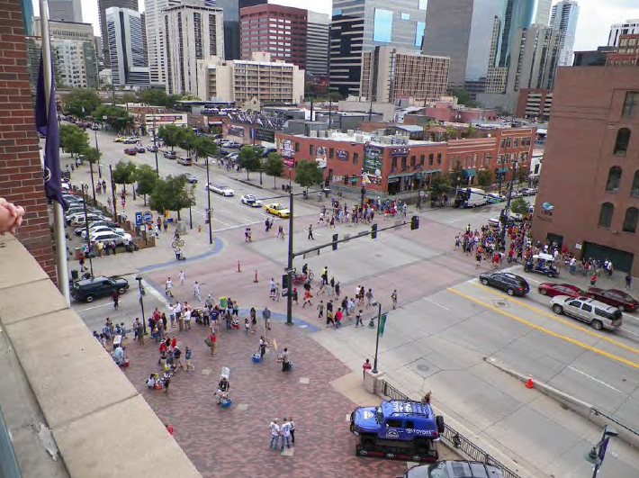
Figure 3.3 – 1: Denver’s emphasis on walkability in its Lower Downtown are manifested in wide sidewalks, at-grade crossings, short blocks, and various other pedestrian amenities.
In 1993, Denver opened Coors Field, a baseball stadium for MLB’s Colorado Rockies. Located in the lower downtown (LoDo) district of primarily historic buildings, the stadium spurred an overhaul of the city’s urban form. Since the stadium’s opening, LoDo has seen an 408% increase in housing units (most of them lofts in historic buildings), a 25% increase in hotel occupancy, and well over 70 new bars and restaurants (Spear, 2015). In addition to the baseball stadium, LoDo is also home to a sports arena (Pepsi Center), amusement park (Elitch Gardens), Denver’s commercial district (16th Street), and the city’s iconic Union Station.
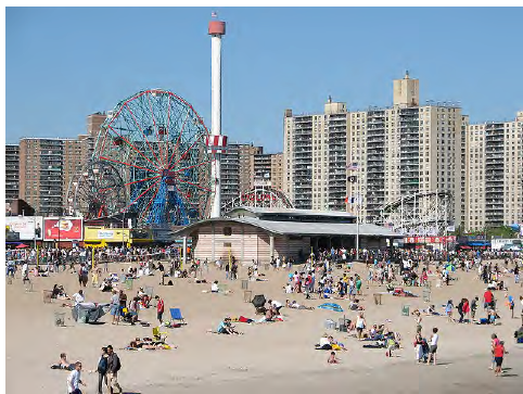
Figure 3.4 – 2: Coney Island progresses quickly from beachfront, amusement park, and commercial activity, to high
density residential. This is a rare, albeit strong example of residences being directly adjacent to entertainment and
recreation land uses.
During Superstorm Sandy in 2013, parts of Coney Island were critically damaged. This revealed a deficiency in the community, a vulnerability to hazards (Mironova, 2014). Especially since the community consists of primarily low-income residents in public housing, Coney Island is particularly subject to environmental harm (NYCEDC, 2016). Since the storm, the city has undertaken a Coney Island Creek Resiliency Study to identify hazards and how to manage those hazards (NYCEDC, 2016).
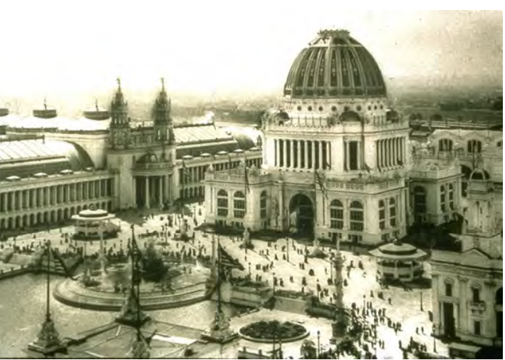
Figure 3.5 – 2: The exposition incorporated many classical city features that had been neglected by urban designers of that era.
Other than the ramifications of electricity on cityscapes, the exposition played a major role in the way cities should be seen and used. While falling short of its lofty goal of being the model for Chicago’s future, the exposition did heavily inspire the 1909 Plan of Chicago, also designed by Daniel Burnham. Burnham went on to create similar plans for Cleveland, San Francisco, and Washington D.C., effectively launching the City Beautiful movement (Wolski, 2009, p.165-168).
CORRIDOR DESIGN GUIDELINES
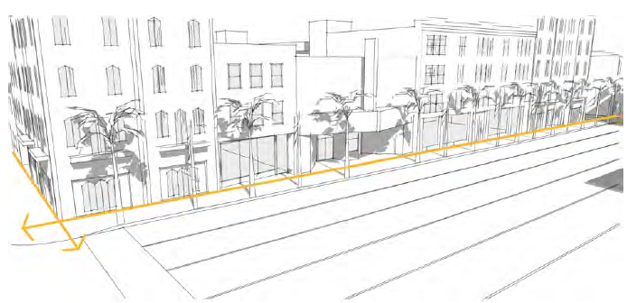
Figure 4.1 – 1: Aligning buildings along the same frontage, with minimal setbacks, establishes a strong linear environment. Minimal setbacks encourage sidewalk activity by reducing the distances pedestrians need to cross to reach their destination.
Pedestrian activity has been shown to increase in areas that follow a more traditional urban fabric. One of the many traditional features of cities that were lost due to sprawl was the easily walkable neighborhood that faced the street. The interaction between the street and the building has been dominated by automobile use for the last 60+ years.
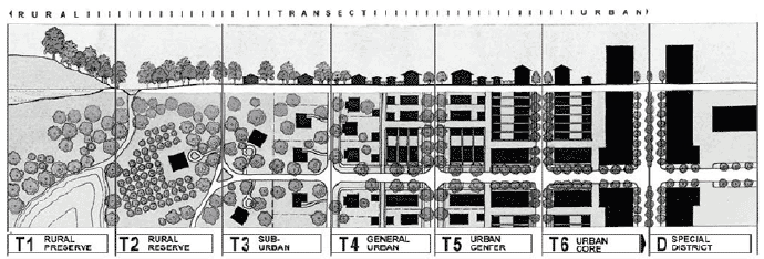
Figure 4.1 – 4: Developed by architect and planner Andrés Duany, the urban transect divides cities based on the density and intensity of urbanization, from rural to urban core. This guides the creation of a more appropriate transition of building height, size, and density.
Denser development is often inaccurately portrayed as a catch-all solution for creating a more vibrant downtown, or city. Denser developments and a larger mix of uses work best when they consider the context of where they are being located (Speck, 2012, p.215). Development needs to match the height and scale of the area they are located.
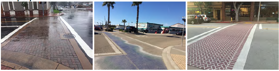
Figure 4.4 – 11: Various techniques involving color and texture can be used to increase the visual prominence of crosswalks. Pavers (left), textured paint (center), and concrete treatments (right) all stand out better against the street compared to traditional striped crosswalks.
Whereas sidewalks in the Anaheim Resort area already feature different textures and patterns than ordinarily, crosswalks should also be demarcated with unique treatments. This draws more attention to the crossings, making it safer for foot traffic. In addition, this gives an opportunity for the city to be creative and create memorable designs, enhancing the corridor’s unique aesthetic.
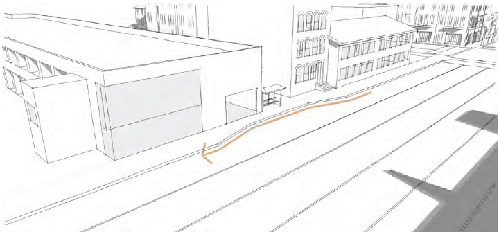
Figure 4.4 – 13: Transit can be improved by instituting formalized transit infrastructure, like bus turnouts and permanent bus shelters.
Transit should be given equal consideration as a reasonable transportation mode. This can only be accomplished if current transit systems are improved. All stops along the corridor should be identified with not only signage, but shelters as well. Where possible, bus stops should incorporate bus turnouts. This removes stopped buses from lanes of traffic, and making it safer and more comfortable for passengers to board.
Source: California Polytechnic State University
Authors: Priit Kaskla